Midok logo
Facebook logo Instagram logo

Professional Road and Adventure Maps for Your Caribbean Travels

Acceptance Mark

To buy this map:

$12.95 USD each
Shipping included
Payments secured by PayPal
All currencies,
credit cards accepted
Map cover Map cover

Collectivité de Saint-Barthélemy (St. Barth's)
Caraïbes françaises / French Caribbean

Plan des rues avec index, sentiers de randonnée et sites de plongée
Street Map with Index, Hiking Trails and Diving Sites

[1 : 10 000]

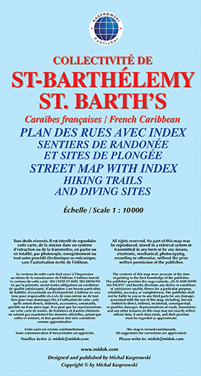
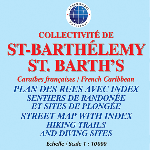
This first and only complete road and street map with a street index of St. Barth's (Scale 1 : 10 000) renders all the island's known roads and streets with their names - current names in French, historical names in Swedish, shows hiking trails and points to diving sites with their GPS coordinates.

The map is sold folded, measuring 4 7/8" x 8 7/8" (12.5 cm x 22.5 cm), and is designed for easy opening and refolding. Its full unfolded format is 26 3/8" x 38 1/2" (67 cm x 98 cm).

It contains the following features:

  • Attractive full color layout;
  • Rich topographic detail;
  • Symbol key and scale;
  • Inset of capital Gustavia, main and secondary roads, diving sites, shipwrecks, hiking trails, beaches, bridges, an airport, lighthouses, reefs, geological formations, marinas, ports, ferry lines, churches, cemeteries, protected zones, moorings, gas stations, parking areas, and other points of interest;
  • Depth curves, soundings in meters, longitude and latitude lines and other identifiers.

See excerpts of this map